
Did you know that Ida-Viru County is the most record-rich region in Estonia?
A mapping project conducted by the University of Tartu in the summer of 2020 confirmed that the capital of Estonia’s natural and man-made records is right here – in Ida-Viru County!
In Ida-Viru County, nature and people together have created something truly extraordinary. A total of 34 record sites were identified, making the region a true dream destination for explorers and discovery seekers.
The records of Ida-Viru County are not just numbers and facts – they are experiences waiting to be lived!
Many of the record sites (19 in total) are marked and easy for visitors to find, inviting you to take photos, explore, and share your own “record-breaking moment.”
When entering the county, visitors are greeted by boundary markers – from Tallinn’s direction in Purtses, and from Tartu’s direction in Rannapungerja.
In the border city of Narva, the markers welcome visitors at the railway station, Narva Gate, and Narva-Jõesuu harbor.
Discover how extraordinary Ida-Viru County is – Estonia’s land of adventure, where records are waiting to be uncovered!
You can read below what makes these records so special and worth visiting – without even leaving the warmth of your home!
Lists of Estonian settlements begin with the name of the village of Aa, and Aa is also the first word in encyclopaedias. In 2019, the village of Aa was declared the crossword capital of Estonia. The winner was chosen from among the ten most common place names in crosswords. Aa can refer to a village on the northern coast, a manor,
or a beach, the latter being a popular rest area among the locals. Whereas the summer, autumn, winter, and spring capital are related to the season, Aa can be the crossword capital all year round.
Behind the short name is a dispersed seaside settlement first mentioned in 1242 in a Danish book of land taxation. At the time, the name Hazæ was used. Over the centuries, various versions of the name have been in circulation, including Häcke, Haka, and Haküll, but these would hardly have enchanted crossword-makers as much as Aa. “Aa” is also often used in colloquial speech as an exclamation expressing sudden comprehension or recognition.
The first letter of the alphabet is the most frequent in texts in Estonian and the only one present in Aa.
The Estonian Mining Museum in Kohtla-Nõmme is a special place, as its underground part is located at the depth of eight meters. When seeking the deepest experience in Estonia, keep in mind that the temperature in the mining shafts is eight degrees Celsius year-round. The best aids in defying the dampness, coolness and darkness are a miner’s coat and the faith in returning to daylight sooner than later – in contrast to real miners, who spend their entire working day underground.
The museum’s special features include former miner guides and operational machinery. The guides are also technicians keeping in order the drilling machines, loaders, and combines they set in motion during the tour. The powerful machinery remained in operation at the Kohtla mine until its closure in 2001.
The visitors can ride a functional underground miner train. Indeed, the museum is the only place where the underground railway still exists. In operating mines, adapted cars are used to transport the miners to their workplaces.
In the premises of a former explosives warehouse, school students from the Toila rural municipality have created the deepest escape room in Estonia chosen as the best new adventure in the Ida-Viru County in 2025.
Ziplining is the crown jewel of adventure centres. In Estonia, the longest zipping through the air can be experienced at the Kiviõli Adventure Centre. The 600-metre descent begins from a tower built at the top of the man-made hill and the speeds can reach up to 80 km/h. At the end, a braking system ensures smooth arrival. Therefore, it is both an adrenaline-imbued and safe opportunity to feel the taste of true freedom for 30 seconds.
At the core of the Kiviõli Adventure Centre is a 90-metre man-made hill. In addition to ziplining, the visitors can race down the hill by bicycles, tubes, and so-called mountain cars. All of these attractions await at the summer park intended for the entire family, where adventurers of all ages can find activities to their liking.
In winter, Kiviõli is known as the ski resort with the longest slopes in the Baltic region. You can rush down on skis and snowboards on four 400–700-metre slopes. There are also two training slopes for beginners.
The Kiviõli Adventure Centre is an excellent example of recycling. The former semi-coke mine waste hill now offers dizzying experiences and the heat concealed within it is cleverly used for heating the service building.
In 2012, mining operations in the Aidu quarry were terminated due to the depletion of oil shale reserves. After that, the ground was levelled and afforested and the trunk of the rowing canal formed. When the pumping stations were closed, the passages in the quarry gradually filled with water. This way, a distinctive comb-shaped system of artificial water bodies was created.
Today, the former excavation area with its mystically clear light blue water and high banks resembles a fjord located in the middle of a rocky desert gradually being taken over by the forest.
As a result of the rehabilitation of the industrial landscape, a water sports and adventure centre is now operating in Aidu. At its heart is the only man-made Olympic-size rowing canal in Estonia. In addition, Aidu has dozens of kilometres of canals for rowing, paddling, and practising water motorsports. There is a wakeboard park to attract the enthusiasts. Swimming in the outdoor pool is a pleasant experience as well.
The exciting quarry landscape shaped by excavator buckets is also a hiker’s paradise; it can be explored on foot, by mountain bike, or by taking part in adrenaline-filled quarry safaris.
The first shale oil industry in Estonia, located in Kohtla-Järve, is depicted on the 100 krooni banknote that came into circulation in 1935. This shows just how important the oil industry was for the young state. The first oil tower still exists today.
Initially, oil shale was only used as solid fuel, but from 1920, emphasis was placed on the oil industry in the hope of adding value to the natural resource. A prototype of the oil refinery was developed in Germany; based on the knowledge gained through this, a pilot plant was built in Kohtla-Järve in 1921. To produce oil, oil shale was heated at 500°C.
The oil extraction experiments were successful, and in 1921, the Government of Estonia decided to build a large-scale shale oil plant in Kohtla, which was commissioned in 1924. The raw material produced could be used, for example, as fuel for ships and locomotives. Bitumen, a residue from the distillation of crude oil, was used as roofing tar; supplemented with mineral
substances, it could also be used for asphalting roads.
The key to further development of the oil industry was production of oil shale gasoline for the purpose of reducing Estonia’s dependence on imported oil. Shale gasoline and shale oil were also successfully exported; the fuel oil was used in German warships, for example. Estonia’s shale oil industry became profitable.
The first written references to combustible stones date back to the 18th century. Oil shale soon attracted scientific attention; studies suggested that it could be used both as a solid fuel and for the production of liquid fuel, but there were no immediate developments after this discovery. Oil shale became of value for the Russian Empire only during the fuel crisis resulting from World War I, when coal supplies stalled.
In 1916, the first prospecting shafts were made in the area where the Järve district of Kohtla-Järve is located today. The oil shale extracted from there was transported in 22 rail cars to St. Petersburg, where tests yielded positive results. That same year, planning of the first oil shale quarry (located on the territory of today’s Kohtla-Järve) began.
The first underground mine, however, was commissioned
in Kukruse, a few kilometres away. Oil shale had been extracted manually in Kukruse already in the 1870s, when Robert von Toll, the local landlord, used it to heat the kilns of his distillery. The academic name of Estonian oil shale, kukersite, derives from Kuckers, the German name for the Kukruse manor.
The data available on the exact height of the Valaste Waterfall vary. The height increases after downpours and decreases with landslides. Rounding the numbers, the wall of water is 30 metres high, which means that Valaste is four times higher as compared to Jägala Waterfall, the widest and perhaps best-known waterfall in Estonia. Unlike Jägala, however, the Valaste Waterfall is not a work of nature, but was created in the course of land improvement and
receives its water from the Kaasikvälja drainage ditch (aka Valaste stream). The Valaste Waterfall roars down from the highest and most spectacular section of the Baltic Klint – right here at Ontika, the limestone cliff peaks at 55 metres above sea level.
The Valaste Waterfall is at its best during high water in spring, as well as in winter, when the waterfall and trees freeze. This happens at sub-zero temperatures, when the north wind blowing from the sea forms picturesque ice sculptures using splashes of water. In summer, you can admire the dense and lush cliff forest. Thus, at Valaste, one can end up in both in an ice world and a jungle.
For the best view of the stream and the forest growing below the high cliff, walk the Valaste hiking and study trail. From the stairs, you can also see a geological cross-section of layers formed over hundreds of millions of years – and the striped pattern is surprisingly colourful.
The first written records of the Church of St. Michael in Jõhvi date back to the 14th century, though its architectural
features suggest an even earlier origin. For a rural church, it is unusually large, resembling more a monastery or bishop’s church. It has been considered the largest single-nave church in the Baltic States and the only one in Estonia surrounded by a moat.
Equally unique are the vaulted crypts beneath the altar, similar to those in the abbeys of Kärkna and Padise. No other rural church in Estonia has such cellar rooms. Today, they form part of the Museum of the Fortified Church of Jõhvi, which presents fascinating discoveries and stories – including the legend of two brothers, in which one, in a fit of rage, killed the other and, remorseful, built a church instead of a fortress.
It is the only fortified church in Estonia once enclosed by a circuit wall and moat. The church had a defensive gallery along its outer edge, and the tower is equipped with numerous firing slits. The building was likely converted into a fortified church after its destruction in a battle in 1367. During the Livonian War it was besieged twice and, on February 3, 1558, captured and destroyed.
The Church of St. Michael in Jõhvi also made history in 1865 when it hosted the first song festival in Northern Estonia– the first regional song festival in the country. The Jõhvi song festival was thus an important milestone on the road to the first nationwide song festival.
After World War II, construction of neoclassical centres as planned in several towns of the Ida-Viru County. However, because of the post-war poverty standing in the way of all the grandiose plans, gorgeous town centres were built only in Sillamäe and Kohtla-Järve.
In Sillamäe, the town centre is very well preserved and is currently the best example of a 1950s neoclassical architectural ensemble spearheaded by the pompous Cultural Centre.
Sillamäe is also a good example of the influence of nature on urban planning. The town was built to a place where interruption of the klint allows access to the sea. This geological peculiarity is expressed particularly well by the wide stairs descending from the central square located on top of the cliff to the Sea Boulevard. Because of its magnificent stairs, Sillamäe has also been dubbed “Odessa of the Baltic Sea”.
During the Soviet era, special permits were required to enter Sillamäe, as the town built next to a uranium enrichment plant was so secret that it was not even marked on maps. Today, the Sillamäe Museum tells the story of the mysterious town.
One could think that Narva-Jõesuu, the most famous resort in the Ida-Viru region, was also the very first. In fact, Sillamäe preceded Narva-Jõesuu by a couple of decades. Sillamäe was mentioned as a holiday destination as early as in 1852. The eight-kilometre-long resort area was located along the seashore between the Sõtke River and the Perjatsi Stream.
The number of summer residents started growing particularly fast in 1870, after establishment of a railway connection to St. Petersburg, the capital of the Russian Empire.
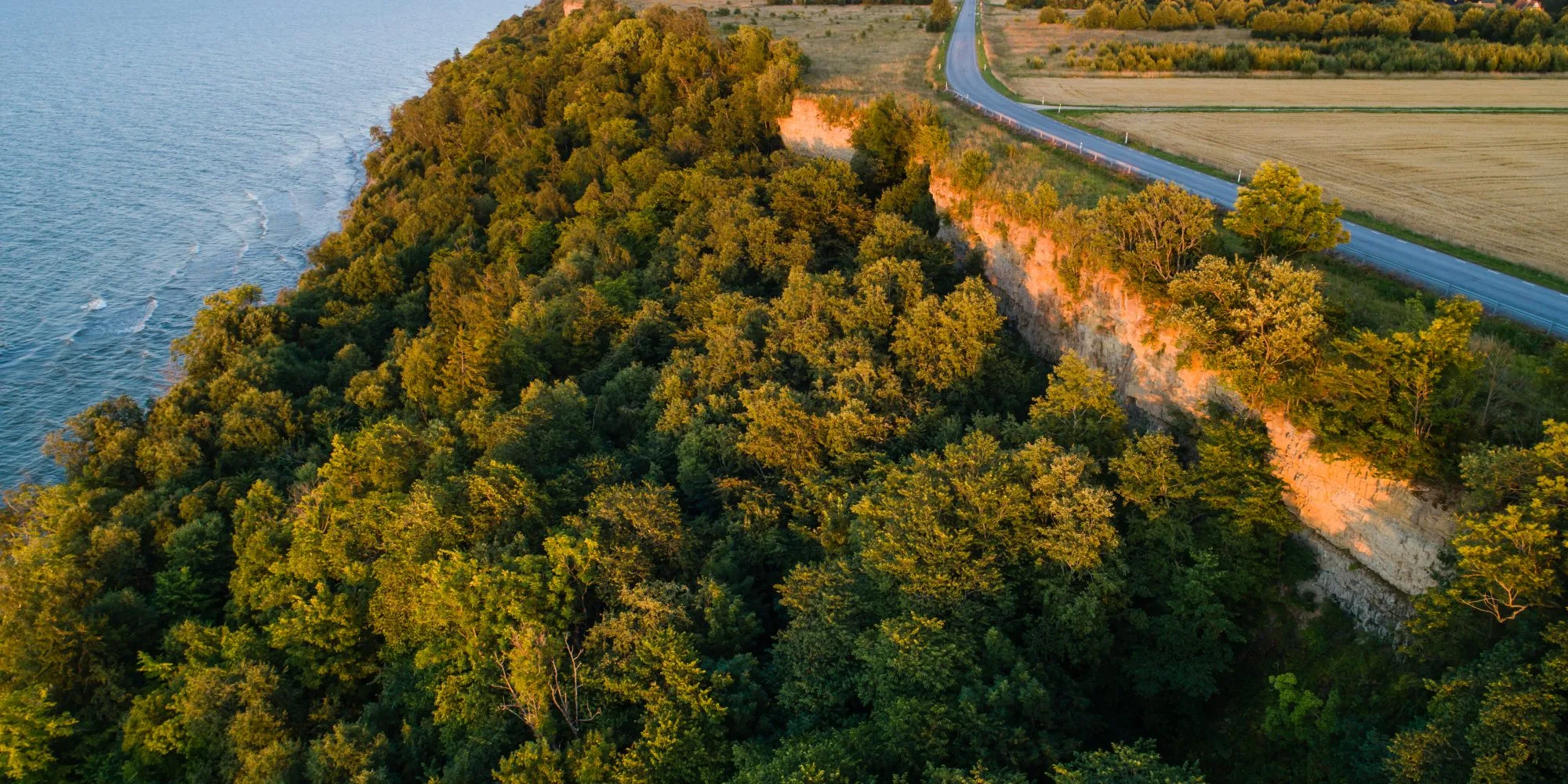
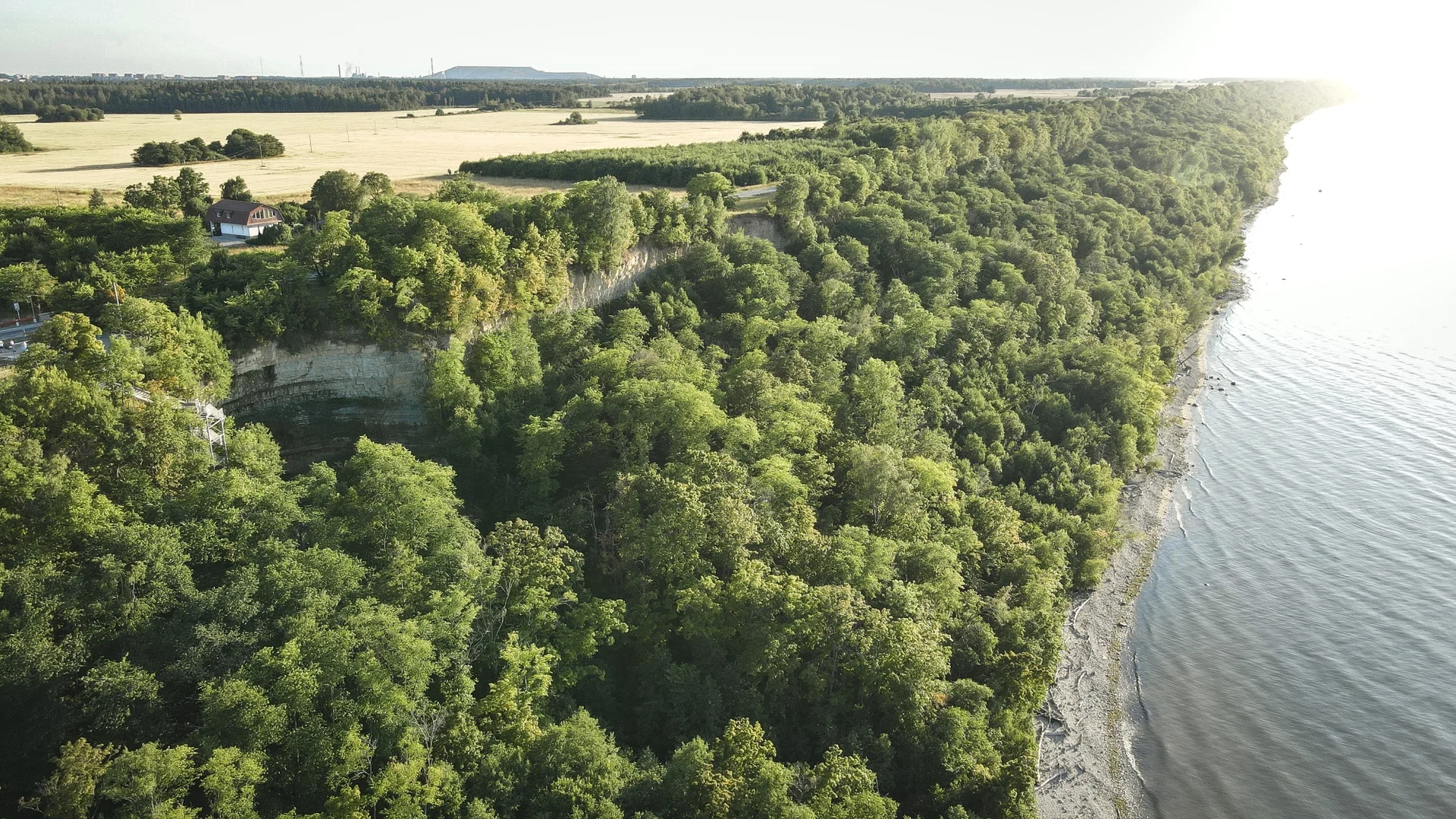
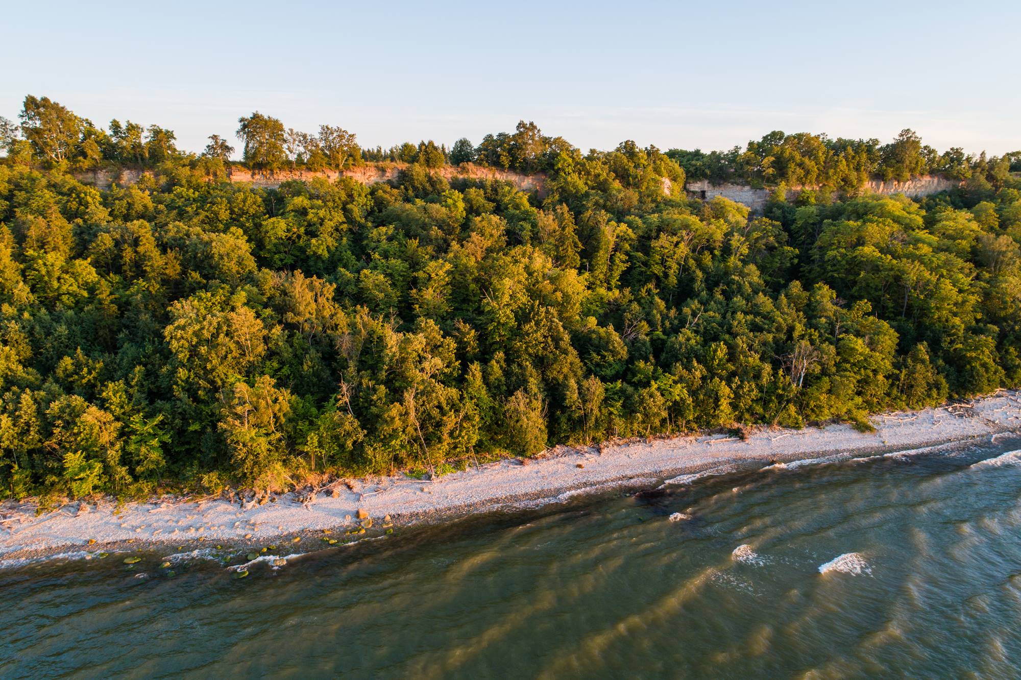
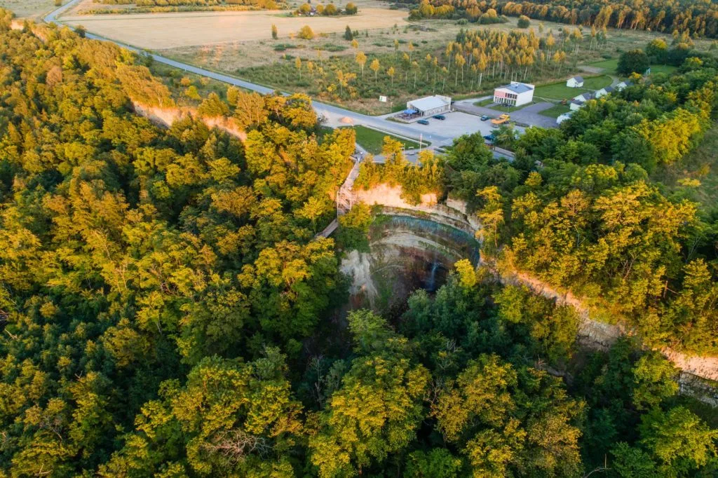
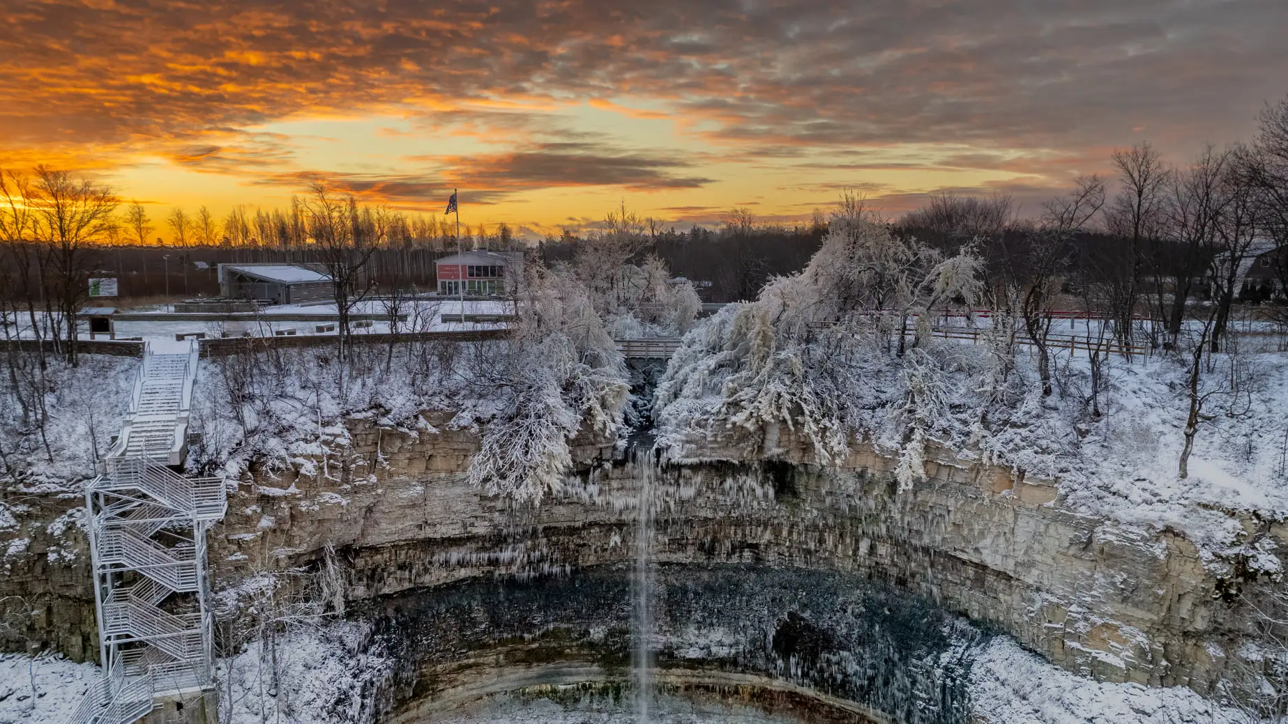
The beautiful nature of Northern Estonia attracted more and more holidaymakers, and other resorts, such as Narva-Jõesuu and Meriküla, emerged in the area.
The glory days of the Sillamäe resort occurred around the turn of the 20th century. In the best summers, 1,500–1,600 holidaymakers stayed here. During World War I, the holiday homes were neglected, and after Estonia gained independence, spending holidays in Sillamäe never really gained the right momentum. A decisive change in the life of the region happened in 1928, when an oil industry was established in Sillamäe. From that time, Sillamäe has been better known as an industrial centre. Nevertheless, the gorgeous nature for which Sillamäe was once considered the most beautiful resort area in North Estonia is still there.
The Sõtke River originating from the Kurtna Lake District flows into the Sillamäe reservoir located 22 km away. In the town of Sillamäe, the river has been dammed up with three dams to form a cascade of reservoirs unique for Estonia, with a total damming height of 11.65m. The resulting reservoir cascade is unrivalled by difference in height in Estonia.
The area of the largest reservoir is 30 hectares and its average depth is 7m. Prevailing fish species are perch, roach, pike, and bream.
After the reservoir, the Sõtke River runs along the seashore and finally flows into the sea near boathouses that the locals call “Shanghai”. In the very heart of the town, wide stairs descend towards the sea. The Sea Boulevard smoothly transitions into a coastal promenade where fountains, playgrounds and ball fields, an adventure trail, an observation tower, a pumptrack, and cafés please the eye and provide possibilities for active leisure.
Near Sillamäe, another impressive set of stairs, this time of natural origin, accommodates the Langevoja Cascade. The spring-fed waterfall consists of two ledges; the canyon widens beneath the waterfall. After a three-hundred-metre drop, the stream runs into the Sõtke River. A campfire site perfect for having a picnic has been built next to the waterfall.
The longest seaside resort beach in Estonia with a measured length of 9.5 kilometres is located in Narva-Jõesuu. For comparison – the four beaches in the resort town of Pärnu are only 3.9 km long and barely half of this length is pleasantly sandy.
On the long and wide beach in Narva-Jõesuu, everyone can enjoy his or her preferred level of privacy. The beach with its fine white sand is an excellent place for long walks, cycling, and admiring enchanting sunsets. After all, Narva-Jõesuu is called the town of 1,000 sunsets for a good reason.
Because of the natural charms of Narva-Jõesuu, its history as a resort dates back to the 1870s. Today, resort life includes beach cafés, a surfing club, boardwalks, playgrounds and ball courts, restaurants offering local cuisine, and a diverse summer events programme.
The Narva-Jõesuu beach starts at the mouth of the Narva River and extends all the way to the Udria Cliff and glacial boulders. At the mouth of the river, Estonia’s easternmost lighthouse awaits visitors. The lighthouse’s location in the middle of the town is unique, and the same goes for the view – you can marvel at both the sea and the river, see what is going on in Narva-Jõesuu, and catch a glimpse of Russia on the opposite shore of the Narva River, all at once.
The fortifications in the historical centre of Narva constitute an excellent example of defensive structures from different eras. A castle from the times of the Order, a medieval city wall supplemented with roundels (round towers), and 16th and 17th century bastions, as well as ravelins (outer works) exist here side by side. The preserved and restored fortifications are true gems in terms of both military history and architecture.
The earthworks surrounding the town were mainly built in the 17th century, during the Swedish rule. Under the leadership of Erik Dahlberg, a renowned Swedish military engineer and architect, six new bastions were constructed, all of which but one are still there. It is the best-preserved bastion system from that period in Estonia.
The former fortifications have now become a tourist attraction important for the border town. There is a museum with a fascinating exhibition in the Narva Castle. The mightiest bastion, Victoria, is also open to visitors. In its casemates (tunnel-like vaults) and the gunpowder cellar, you can learn about the history of Narva’s defense system.
Founded on an island in the Narva River in 1857, the Kreenholm Manufacturing Company consisted of five mills by the end of the century and was among the largest, if not the largest, of its kind in Europe. Before World War I, the worker count reached 10,000 and the company had grown into one of the largest textile companies in the world.
Unlike today, the look of industrial buildings was considered important when Kreenholm was constructed. Because of this, the architecture of the former textile giant is still stunning. The vast scale of Kreenholm attracts filmmakers from near and far, even from Hollywood. Organisers of major events, such as the Narva Opera Days, have discovered the courtyard and pillared hall of the old spinning mill.
At present, the closed industrial area is only accessible during events or with tours arranged by the Narva Museum. One of the tours focuses on the Joala mill; the climb from the basement to the top of the water tower offers breath-taking views of the entire industrial complex.
The Narva Reservoir was created in the early 1950s for the Narva Hydroelectric Station and the Narva Power Plants. To this end, the bed of the Narva River above the Kreenholm Island was sealed off with a concrete weir. According to the latest measurements, the area of the artificial water body is 110km², one-sixth of which belongs to Estonia.
There is a system of canals along the Narva Reservoir lined with endless rows of boathouses known as the Narva Venice. In the Soviet times, building a summer home between the canals seemed a good idea. Back then, the Russian side was also accessible by boat for fishing or picking berries and mushrooms. Even now, the some tens of square kilometres currently belonging to Estonia offer ample opportunities for active leisure.
The boathouses boasting unique architecture are more than just shelters for storing a boat – they are used for living, fishing, gardening, sauna, BBQ, and parties. The aquatic lifestyle of the Narva Venice fascinates tourists and creative people alike. The summer project Narva Venice Embassy, which has become a tradition f the Narva Art Residency, invites artists to live and
create their works in the region.
Besides serving as a natural border between Estonia and Russia, the Narva River is known for its mighty discharge and multiple islands. In total, there are 120 islands of various size in the Narva River and Reservoir, although many of these are temporary sediment deposits. There are some ten larger islands in the river, the largest of these being the Permisküla Island, which has even been confirmed as a habitat of the rare flying squirrel. There are no people living on the islands of the Narva River, but in the 19th century, a huge textile factory was founded on the Kreenholm Island.
The Narva River is the largest in Estonia by several hydrological characteristics. For example, its discharge is unrivalled, leaving the Emajõgi and Pärnu rivers far behind. There is also a two-tiered waterfall on the Narva River, which was once the largest in Estonia, at least in terms of water power. However, after the construction of the hydroelectric power plant in 1955, the Narva falls have been dry. Only occasionally in spring is excess water
released down the old riverbed by Russia and those interested can enjoy the roar of the waterfalls. In summer, the ferry Caroline commutes between Narva and Narva-Jõesuu, offering its passengers gorgeous views of the magical Narva River.
The Tuhala Witch’s Well in Harju County only pours out during spring floods, when water pressure builds up in the underground river, whereas the Three Witches’ Well in the Kose forest functions throughout the year. While the karst spring in Tuhala is a natural wonder, the three dome-shaped fountains in the Ida-Viru County are a gift from the oil shale industry.
The pipe springs were built in 2005 to lead excess water out from the closed Ahtme mine. Rising through the holes drilled in the ceiling of the mine shaft, excess water reaches the Pühajõgi River through the Sanniku stream. At present, significantly less water flows out from under the ground as compared to the first years. Nevertheless, it is the only year-round functioning witch’s well in Estonia. n Ratva, two boreholes bubble up during high water.
The witch’s wells there were created thirteen years later, but for the same purpose – to remove excess water after the closure of the Viru mine. The primary function of the artificial springs is to prevent flooding of surrounding fields and forests, but they are also fun to watch during high water. Thus, manmade witch’s wells have developed into an attraction nique for the Ida-Viru County.
The Narva River has its source near the village of Vasknarva located at the north-eastern end of Lake Peipus. In the past, sediments from the lake brought in by the prevailing westerly winds and the river often blocked the source. Because of this, the so-called fifth season (or high water season) similar to that in Soomaa once existed here. Vasknarva suffered a massive flood in 1924, for example.
The fifth season became a thing of the past in the 1930s, when the Estonian state commissioned a unique system of hydraulic structures at the source of the Narva River. Four groins (in other words, transverse dykes) were built on the west bank of the river, plus a dam diverting the flow on the east bank. The transverse dykes narrowed the Narva River, accelerating its flow and collecting the sediments between them.
The best view of these huge inland hydraulic structures
opens from the northernmost groin. You can get there from behind the Vasknarva Orthodox Church. Walking to the end of the groin, you may well feel as if you are about to reach the end of the world. The Church marks the beginning of the Vasknarva village, which is also known for the ruins of an order stronghold and a developing harbour. The longest sandy beach in Estonia
starts here. A new observation tower located next to one of the groins offers an excellent view of the lake, the river, and the migratory birds stopping here.
The longest sandy beach in Estonia is situated on the northern shore of Lake Peipus. It meanders uninterrupted for 32 kilometres between Rannapungerja and the source of the Narva River. In terms of length, it beats hands down the Monolithi beach in Greece, which is advertised by several tourist information sources as the longest sandy beach in Europe.
Actually, Lake Peipus could easily be mistaken for the sea – when looking straight across, there is no end to it. Although the salty sea air is missing, the pleasantly warm bathing water makes up for it. Other attractions of the northern shore of Lake Peipus include the soft, “singing” sands, high dunes, and airy pine forests.
Kauksi, the most famous of the beaches of Lake Peipus, invites you to walk on the promenade and rest your feet on the viewing platforms. In Kauksi, holidaymakers can also find the Beach House, camping areas, hiking trails, accommodation and dining services, and the Visitor Center of the Alutaguse National Park – Estonia’s youngest national park.
In winter, ice conditions allowing, Lake Peipus becomes a beloved fishing destination that attracts people from near and far. In spring, strong winds sometimes pile up ridged ice heaps the size of a building, creating a magical sight. Many people drive for hours just to see this natural wonder and take photos of it.
Discover the natural and man-made record-breaking sites of Ida-Viru County and share your impressions with friends!
Sign up for the newsletter